Local History
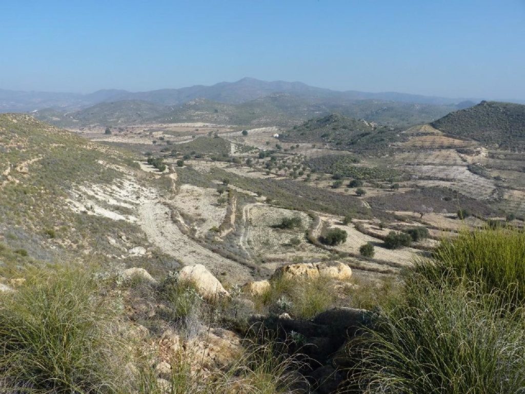
El Pilar lies right on the boundary between its two nearest towns, Sorbas and Lubrín. This whole area is very rural and peaceful. Driving around is a delight on winding country roads with almost no traffic. And hidden away in the settlements and the landscape are many clues to the past.
El Pilar lies right on the boundary between its two nearest towns, Sorbas and Lubrín. This whole area is very rural and peaceful. Driving around is a delight on winding country roads with almost no traffic. And hidden away in the settlements and the landscape are many clues to the past.
Near La Mela, just south of El Pilar, such prehistoric people have left evidence of their presence. Ancient rivers had cut steep-sided valleys in the old reefs that make up the geology here, and on these valley sides are many overhangs and shallow caves. In one of these, in the Mora gorge, is an abrigo, a shelter, where the rock wall is covered with fading red ochre drawings. They depict human figures with their arms in various positions, and there are fish-bones (or tallies), zigzags, and patterns of diamonds and triangles. These drawings are considered to date from between the Neolithic Era and the Age of Copper, 6000 to 3000 years ago. The La Mela cave paintings can be visited but are protected from the attention of careless visitors by a tall metal fence.
Jumping ahead many centuries, it was during the time of the Moors that records of the area began. Sorbas, known then as Surba, owes the building of its castle (now all disappeared) and the layout of its narrow streets to this period. The Moors were skilled at crafts and at making the most of local resources. The pottery quarter, the alfarería, in the lower part of Sorbas, dates from this time and there you can still see a huge Moorish kiln, stained red with the clay of generations of potters.
Farming has always been one of the main sources of work in the area surrounding El Pilar. The presence of elegantly made stone threshing circles, called eras in Spanish, bears witness to the times of more rainfall when cereals, particularly wheat and barley, were important crops. The threshing boards, made of planks of wood fixed together and set with hundreds of flints in rows, were ridden round and round, pulled by horses, to separate the grain from the straw, in an annual tradition that was one of the key moments of the year. Dates carved into some of these carefully crafted threshing circles – 1862, 1899, 1909 – show when they were constructed.
Atalaya
Gradually though, the climate has changed further. Within the lifetime of the older residents the rainfall has diminished. Olives and almonds have become the staple crops, their trees patterning the landscape and giving rise not only to distinctive local products but also to opportunities for visitors to see the countryside at its best. February is the time for this, when the almond trees are laden with creamy white and pink blossom. El Pilar is the starting point for beautiful walks amongst the almond orchards, led by a local expert, and the chance to admire the ‘flor de almendros’ before returning to Albar for a special menu in which almonds are a key feature of many of the dishes.
Mining, for a time at least, was also an important part of the local scene and much of the wealth of Lubrín came from the mines. If you drive north from El Pilar, very soon you will see, on the hillside to the right, two stone chute-like structures. These are the remains of hoppers down which iron-ore was loaded into waiting wagons and trailers. The mines were on the slopes of the mountain called Atalaya which towers above the hamlet of El Pilar. The hill’s name translates from the Arabic as ‘Lookout’, as befits a summit rising to 888 metres. Close by, less than two kilometres south-east of El Pilar, a small iron-ore mine was being worked by the Moreno family until the early 1960s. So it is perhaps not surprising that, in El Pilar’s church, there is an image of Santa Bárbara, the patron saint of miners.
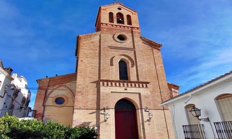
The churches in Lubrín (built in the 19th century) and in Sorbas (dating from the 16th century and constructed on the site of an earlier mosque) reflect the past riches of the area, as do other grand buildings such as the 17th century house of the Duke of Alba, which fronts onto the Plaza de la Constitución, the main square in Sorbas.
Just outside Sorbas, quarrying has concentrated on the extraction of gypsum from the unique and fascinating landscape of the Karst en Yesos de Sorbas, which can best be understood by a visit to the Centro de Visitantes Los Yesares (Los Yesares Visitor Centre) in Sorbas itself, where the intricacies of the scenery are explained, with a mock-up of an underground gypsum cavern. Then, for the real thing, guided underground tours are available at the Cuevas de Sorbas (Sorbas Caves), just a kilometre outside the town.
Today, an increasing number of businesses, including Albar restaurant and casona, are embracing the possibilities for ‘sustainable tourism’…
Celebrating the unique natural beauty of the area and enriching the local economy by promoting guided toursand offering high quality locally grown food in a way which links the past with the present and the future.